Safe Weather Routing
Weather Routing - Safe routing through the wind, waves, and current
Weather Routing does so much more than get you from A to B.
In seconds, know exactly what conditions are ahead, how comfortable the route will be, and how to safely and efficiently avoid bad weather, rough seas and shallow water with the world’s most advanced routing algorithm.
Comfort
Know how your boats motion will be affected.

Know how your boats motion will be affected – photo © Predictwind.com
Hydrodynamic modelling calculates how your unique boat shape will move in all wave conditions. In addition, this feature allows you to view the roll (ability to do tasks onboard), vertical acceleration (predictor of sea sickness) and slamming incidents that your boat will experience along the entire route.
Safety
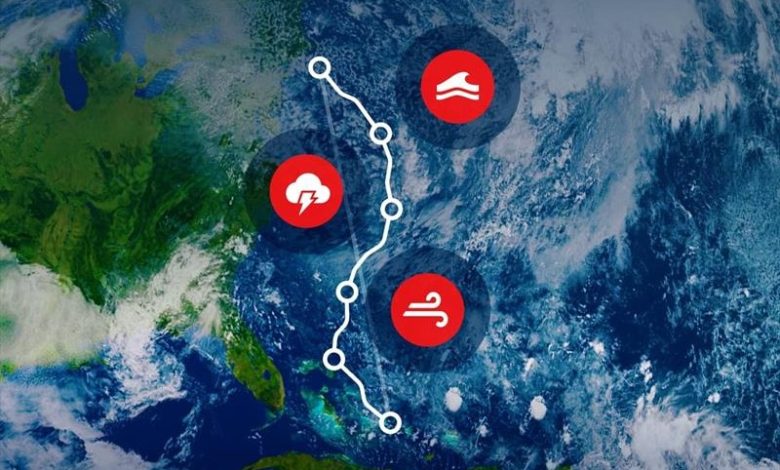
Avoid unsafe weather and ocean conditions.

Avoid unsafe weather and ocean conditions – photo © Predictwind.com
Input your max wind speed and wave height, then Weather Routing will calculate the safest route to your destination while avoiding extreme weather, high winds, rough seas, and shallow water.
Graphs and tables
View the forecast at a glance.

Graphs and tables – photo © Predictwind.com
View graphs and tables to see the forecast for your passage, and easily compare the top six global weather models. See wind speed, direction, gust, depth, temp, rain, currents, wave data and more.
6 Reasons to try Weather Routing
- Ease of use:
With a few taps, find your fastest and safest route through the wind, waves, and current. Just like Google Maps, everyone can use it! - The most accurate data:
Compare the world’s top 6 weather models, for higher confidence in the forecast. Hi-res regional models are also used, when available. - Low data consumption
Weather Routing processes gigabytes of weather data in the cloud. The final route is sent back to the boat at a tiny file size of around 20 KB. - Long range forecast:
Only PredictWind has access to the ECMWF Ensemble forecast that extends to 30 days, giving you the best possible long-range forecast and route. - Al Polars
Al Polars learns how you sail your boat in all wind and wave conditions. Your custom polar results in highly accurate weather routing. DataHub required. - A extreme weather alerts
Be alerted of potential dangerous conditions such as lightning, thunderstorms, rain squalls, wind against current, high gusts, fog and wind chill.

Weather Routing – photo © Predictwind.com
Try the advanced Weather Routing features now with a free 2 week trial of Professional Subscription.
Free trial must be redeemed before 31 March 2024.
Weather Routing Webinar
25 March 2024 (21:00 UTC)
by Predictwind